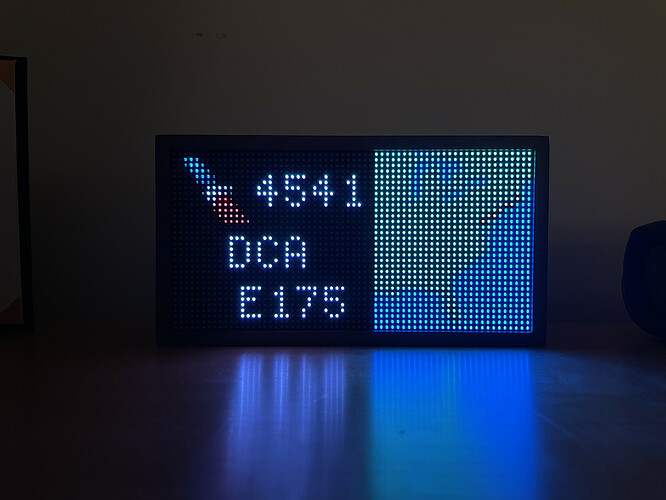
There are so many useful types of displays that could be done. Depends on what you’re looking to do. Currently, we do not have arrival/departure airports (just current lat/lon coordinates), but it’s looking like we will add arrival/departure airports shortly. My other interest is in aircraft flying around not on flight plans (medical helicopters, police helicopters, small GA planes, etc.) Pretty close to having something basic working here.
I am a bit puzzled on why Starlark was chosen as the development language here. There is not a lot of “googleable” material out there on Starlark and it doesn’t seem that well suited for this niche…
An even better idea would be arrival, departure info for your nearest airport with a digitized logo for the airline. I’d love to select “DCA” and see ify flight from DC to Dallas was delayed or cancelled.
So basically an airport arrival / departures board for your nearest / chosen airport? I could have a crack at that, I don’t think it would be too difficult.
I’m working on something like this! It’s working and just needs to be fine-tuned, I’ll post a GitHub repo and full details tomorrow I think. It shows the next departure at the airport of your choice, shows a route map, the aircraft model, gate, time, airline etc.
Definitely the option for all aircraft closest to a location. My hope is to have mine running in my airport operations office and show the next arrival or departure.
It would be great to specify a location and then see the closest flight based on ADS-B transponder data. I live near a flight path and would love to be able to look up at the plane flying over and look at my Tidbyt to see the info about that flight.
I just received my Tidbyt and am loving it. I’m a programmer (day job) and a pilot (hobby). I’ve been tinkering with a METAR app and have this so far. Still needs some polish before I submit to the community.